Mountain State Monday: Kaymoor Top

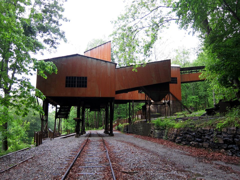
Nestled deep within the New River Gorge near Fayetteville are the ruins of the former bustling mining town of Kaymoor.  Built by the Low Moor Iron Company in 1899, Kaymoor operated until 1962 and once employed over 1,500 men.  Once it closed its doors, the property was left to deteriorate until the National Park Service acquired the property.  Many of the structures are still in a deteriorated state however the NPS does keep up with regular maintenance and tries its best to keep the foliage from swallowing the structures.

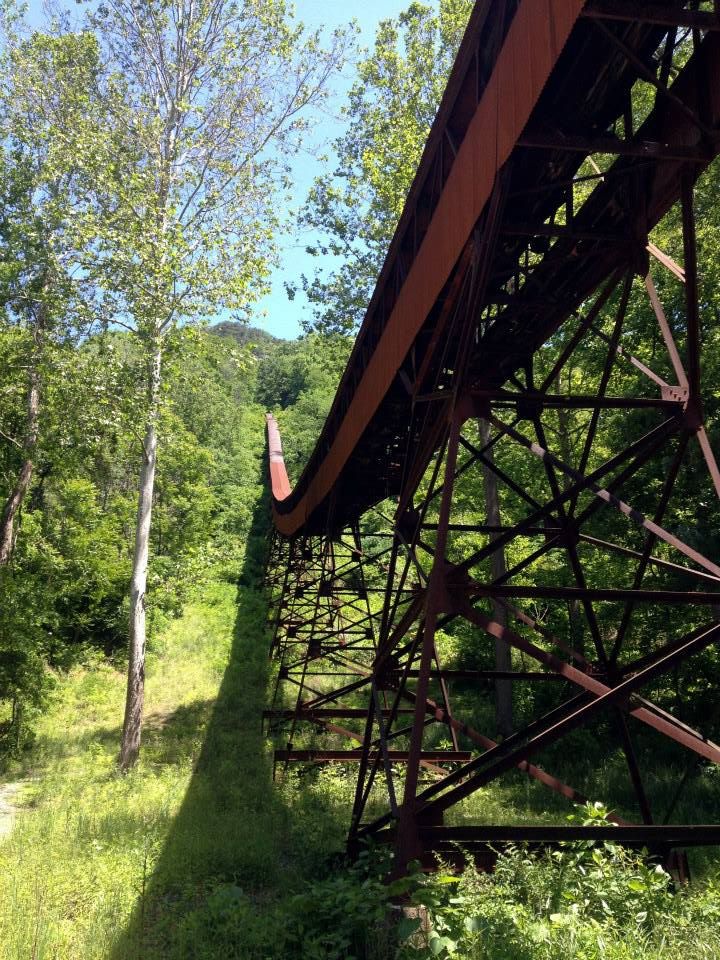
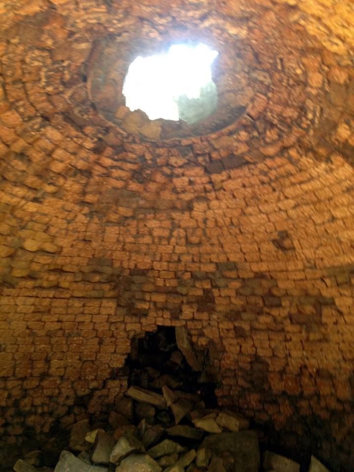
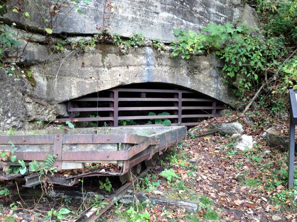
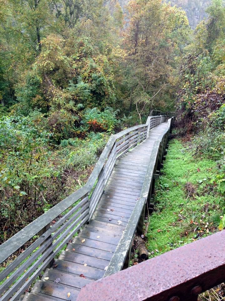
Since the main Kaymoor site sits at the base of the gorge, the only real way to get there is DOWN.  Down 823 steps to be exact.  However, if you are not up to the trip to the base of Kaymoor where most of the structures and coke ovens are, then you can always venture halfway down the side of the gorge to Kaymoor Top.  At Kaymoor Top, you will find the sealed mine opening, abandoned buildings, and the old posts to the rail car system that used to take miners down the mountain.  At Kaymoor Top, you will also find the stairs that will take you down to Kaymoor Bottom.

1375132_10100650814040663_1294143738_n
1378104_10100650814105533_786089575_n

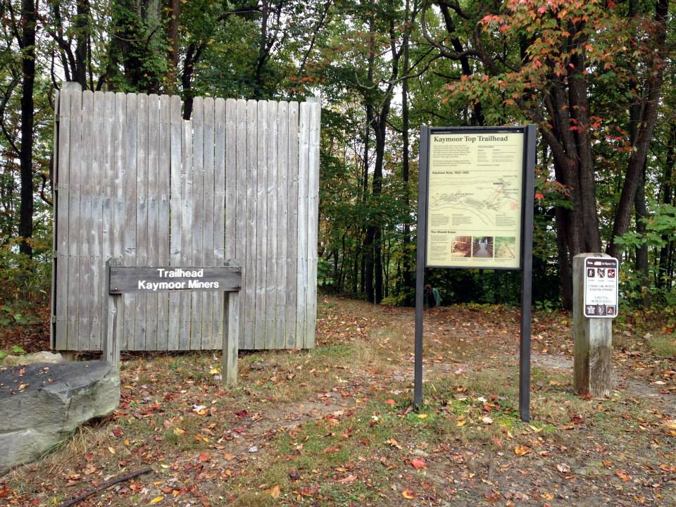
Kaymoor Top is accessible two ways: from the Kaymoor Trail/Wolf Creek Trailhead off of CR-82/Fayette Station Road and from the Kaymoor Miner’s Trail at the tip top of the gorge.  The Kaymoor Trail from CR-82 is two miles with a moderate incline; it’s a fairly long but leisurely trek.  The second way to access Kaymoor Top is from the Kaymoor Miner’s Trail off Gatewood Road, just outside of Fayetteville.  The Miners Trail is only 1/2 mile however it is extremely steep and has rocky switchbacks down the mountain.  I do not recommend the Miner’s Trail unless you are in excellent physical shape, have proper hiking shoes on, and bring with you a good amount of water (a hiking stick may be useful also).  It’s the quicker route but it’s one of the steeper trails in the gorge so please use caution if you attempt.

1380520_10100650814285173_1475699676_n
1384092_10100650814539663_1051939130_n

1380605_10100650814988763_412602333_n
996932_10100650814384973_674760777_n
1380593_10100650814464813_210624457_n

For more information on Kaymoor Top, please visit:
Pictoral History of the town of Kaymoor
Kaymoor Miners Trail information
Kaymoor Trail information

Until next time,
Sara (WV Travel Queen)

Mountain State Monday: Nuttallburg

I apologize that most of my posts reference the Summersville/Fayetteville/Pocahontas areas but I can’t help myself — those counties are my favorite and if I had the resources to pack up and move to one of them, I would do it in a heartbeat.  However, I do try to visit them and share with you their treasures as often as possible.  Like today, for example, as I share with you the long-forgotten mining town of Nuttallburg.

579070_10100149903499403_219557246_n

The restored tipple at Nuttallburg

Located along the banks of the New River lies what is left of the once thriving mining town of Nuttallburg.  In recent years, the National Parks Service undertook a massive project restoring the tipple and conveyor belt as well as installing interpretive signs for the public.  The road to Nuttallburg is a curvy, narrow gravel road that is accessible via Route 60 through the small town of Winona (brown National Parks Service signs will guide you).  Once there, you may explore the tipple or take one of the many trails to see the former company store, coke ovens, or even ascend to the top of the mountain to the mine opening.  If you’re a geocacher, there is also a Nuttallburg Earth Cache that makes the trip extra worth it.  Actually, the way I discovered Nuttallburg in 2012 was because of the Earth Cache; Jon and I were planning a geocaching trip in the area right after the cache was posted and we were some of the first geocachers to visit.  Talk about a new experience!

300903_10100489106947973_1596081329_n

The conveyor belt at Nuttallburg ascends up the steep mountain to the mine opening. A switchback trail will take you to the top.

398935_10100149904003393_375640108_n

There are many coke ovens in the area, some in tact and some crumbled. Many have the entrances grown up, like this one.

969977_10100489107332203_653967510_n

A view of the Company Store foundation at the end of the coke oven trail.

945511_10100489107232403_1467503958_n

Near the Company Store at the end of the trail is a large oven with its dome still intact. While it is tall enough for adults to enter, please be careful as it could fall at any moment.

574536_10100149904407583_1912382668_n

There are many interpretive signs in the area, like this one that shows the layout and trails. When you’re driving down to Nuttallburg, just remember to keep driving — I promise that you will get there, eventually.

 Becuase of the current government shutdown, the NPS website for Nuttallburg is not accessible at this time.  However, the links below provide an excellent history and overview on the town.  Please be advised that there is limited to no cell service in the area; use caution when driving to and from Nuttallburg, as the road is narrow is and not always wide enough for two vehicles.  Otherwise, enjoy your visit Nuttallburg! 🙂
My WV Home: Old photographs of Nuttallburg
Coal Camp USA: Pictorial History
New River WV: Guide to Nuttallburg hiking trails

Until next time,
Sara (WV Travel Queen)