This time last year, I was gearing up for our annual trip to Pocahontas County to see autumn in all its glory. Our usual route beings at Summersville at our cabin and then we cross through Richwood, over Route 150 on the Highland Scenic Highway, stop for lunch at Cass Scenic Railroad State Park, and loop back through Marlinton. If we have extra time, a tour of the Green Bank Observatory is added to the list. This is a route I can drive with my eyes closed as it’s my go-to weekend drive and it’s always beautiful regardless what time of year you’re there.
We do have a similar trip planned to Pocahontas County in October but it’s purely for hiking purposes — no scenic highway, no loop around Cass. This time, we’re going to Watoga State Park in search of a specific shelter I visited when I was little. More on that in the coming weeks though. Today, I want to share with you one of the highlights from last year’s trip through Pocahontas: the Falls of Hills Creek. Prior to this visit, I had hiked to the falls twice but this was Jon’s first time visiting. The day we were there was chilly and foggy but man oh man, was the hike to and from gorgeous!
The Falls of Hills Creek are nestled in the Monongahela National Forest, easily accessible on Route 39 between Marlinton and Mill Point, five miles west of the Cranberry Mountain Nature Center. However if you blink, you’ll miss the turn-off, as it’s unmarked aside from a small brown National Parks Service sign that says “Scenic Area.” Once you turn on the road, there is a paved parking area at the trailhead followed by a 3/4-mile descent to access all three falls. The first waterfall, called Upper Falls, cascades 25 feet and is handicapped accessible via a paved walkway. But, the view isn’t spectacular. If you are able, continue down the boardwalk and paths to the Middle Falls (45 feet) and finally the Lower Falls. At 65 feet, the Lower Falls is a sight to be seen and it is also the third largest waterfall in West Virginia. The Falls of Hills Creek are truly a hidden gem in West Virginia and once you see my photos below, you’ll understand why!

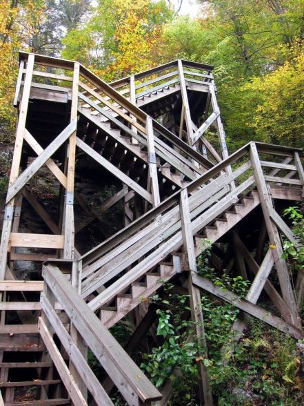
There are two sets of switch backs like this that will take you to the observation platform for the Lower Falls
For more information on the Falls of Hills Creek, visit the Pocahontas County or National Parks Service websites.
Until Next Time,
Sara (WV Travel Queen)


